Water Gap in Lund, Nevada
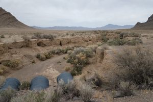
In geology, a "water gap" is an active watercourse that crosses a mountain range. Water Gap is therefore not a misnomer, as it's where drainages from the Grant and Quinn Canyon Ranges to the west, in Garden Valley, converge to cross the Golden Gate Range. They flow out into a playa (dry lake bed) in Coal Valley.
Water Gap was the site of an improbable (and ephemeral) agricultural development project around the turn of the last century. The Cherry Creek Irrigation Company built a dam at Water Gap and platted a townsite, Oneota, with the idea that the stored water could irrigate crops. Unfortunately, the dam quickly washed out and the whole project had to be abandoned. Remains of the dam are said to be visible, but it's pretty much gone now. In fact, erosion has now incised a channel about 10 feet deep through the middle of the gap.
The area now lies completely within the Basin and Range National Monument, so anything that is left is protected. Please take only pictures and leave only footprints.