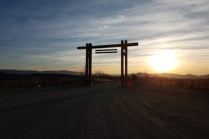
Walker River State Recreation Area in Yerington, Nevada
The East Walker River rises in the Sierra Nevada and flows easterly, entering Nevada about 12 miles south of the town of Bridgeport, California. From there it's another 50 miles to its confluence with the West Walker River, at the south end of Mason Valley, where the Walker River begins.
As might be expected, such an abundant water supply in this arid country was rapidly claimed by Euro-American settlers, and for well over a century there has been very limited public access to the East Walker River, most of the shoreline being occupied by private ranches. In the last ten years, though, the Walker Basin Conservancy has acquired a number of these ranches and deeded them to the state to form a state park, with guaranteed public access.
Currently, the main part of the park is at the north end, on the old Pitchfork Ranch, where the visitor center and a couple of campgrounds are located. One campground has RV hookups with water and electricity. A few cabins, the Antelope Acres cabins, are also available to rent. A hiking trail, the Nature Trail, extends along the Walker River for a couple of miles. This area is also popular for river float trips; check the Pitchfork Ranch water trail map for details.
The other open unit is called the Elbow, at the south end of the river not far from the California line. This is a popular fishing area. It includes a primitive campground, Bighorn Campground, with vault toilets but no water or other amenities.
The Rafter 7 Ranch and Flying M Ranch, along the middle course of the river, were also acquired by the state park and will be opened eventually as the property transfer is finalized and infrastructure built. The park also acquired the historic Ninemile Ranch, south of the river on its tributary Rough Creek, near the old site of Fletcher. This ranch includes what is said to be the oldest Euro-American structure in Lyon County and was a Pony Express station briefly. Mark Twain is thought to have visited there, the place being mentioned in Roughing It